Transforming the Msimbazi Basin into a Beacon of Urban Resilience
Context
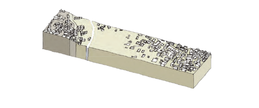
Approximately 1.6 million people currently living in the river catchment with some 50,000 people exposed to flood risk caused by flooding due to poor storm water drainage. It is estimated that 8,000-10,000 households live in areas exposed to river flooding that is considered unsafe and unsuitable for human settlement. A series of flash floods, together with water pollution from toxic industrial effluents, lack of sanitation and solid waste collection, poor wastewater infrastructure, and water borne illnesses negatively impact on the lives, assets and livelihoods of the people living in these areas.
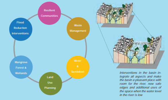
The Integration Principle – this provides the principles to be addressed in a strategic framework in order to transform the area from a liability
to an asset for Dar es Salaam as a resilient city. This framework is broken down into four strategic components.
Strategy No.1: Mitigate
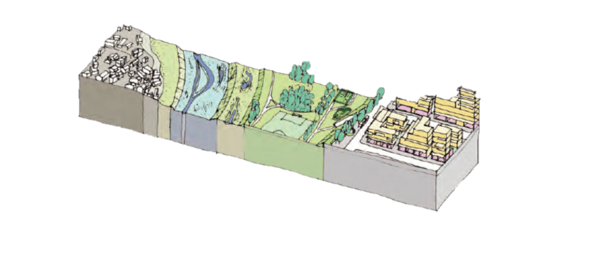
In this plan the Msimbazi River is given room in the Lower Basin to respond to severe peaks of water that it transports from the upper catchment to the ocean. In order for this objective to be realized, a set of interventions is required and sufficient space in the floodplain must be unobstructed to deal with the peak flows:
Flood Intervention A: Dredging a wider and deeper channel between Jangwani Bridge and Selander Bridge
Flood Intervention B: Widening and raising Jangwani Bridge
Flood Intervention C: Dredging a Wider Channel from Jangwani further upstream
Reforestation and rehabilitation of the Pugu and Kazimzumbwi nature reserves – 1000ha increase in the Pugu-Kazimzumbwi forest reserves from 1300 hectares today to 2300 ha.
Preservation and extension of mangrove forests and wetlands in the river plains of Lower Basin – the areas reserved for the mangrove vegetation (forest) and for the saline wetlands can cover the major river plain area between Selander Bridge and Jangwani Bridge -100 ha of wetlands are restored with saline wetlands in the Lower Basin (high water line) and freshwater wetlands further upstream including the Vingunguti area.
Terraces – cut & fill principle
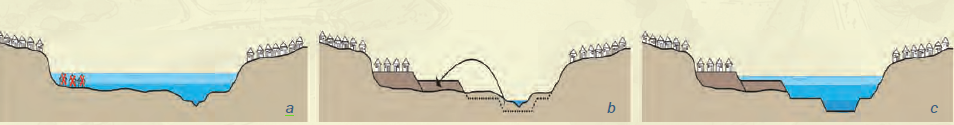
Dredging of the lower basin to remove 200-300,000m3 of sediment annually. The Terrace Concept consists of three levels of elevation which increase in a stepped manner from the river course to the valley edges. The first terrace is approximately 1 meter higher than the floodplain level. This terrace will be used for sports, leisure, agriculture (coconut and tree plantations). The second terrace will be approximately 1 meter higher than the first terrace. This terrace will be suitable for real estate, and would include mixed use including social housing, community amenities, more formal sports fields, and commercial real estate. Approximately 57 hectares of new and safe terraced land can be created which will provide ample space for mixed urban functions. Preliminary estimates indicate potential to develop 14,500 housing units.
Strategy No. 2: Protect
Approximately 10,000 households and businesses are vulnerable to flooding. It is anticipated that some 3,000 households and businesses would have to relocate. This process would have to be appropriately managed.
Strategy No.3: Transform
Aims to improve the Msimbazi river water quality, to improve solid waste management, and to improve city parks.
City Park – an accessible, wide green space that is well connected to the surrounding areas and urban fabric
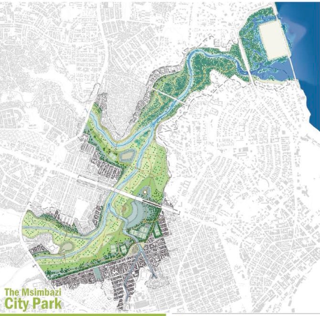
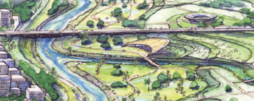
A 400-hectare park is proposed in the lower basin. The central area of the Lower Basin where most functions and activities for people are concentrated. Lowest areas of the lower basin are wetlands, and park space. The city park is to include a number of functions on all elevated levels including for nature, wetland and agriculture use, potential festival space, public sports amenities, and real estate on its edges. Formal designs will establish the quality of this park as a central asset for this Mega-City of the future.
Strategy No.4: Govern
A new Governance body, the Msimbazi Planning Authority will have mandate to stop the uncontrolled urbanization process.
Development Areas Msimbazi Special Planning Area
The terraces create a safe level where new functions can be located without flood hazard. Specific layout designs and development codes for building and public space are required for particular environments of residential typologies proposed (from more compact housing to less compact). Prior to development, an Urban Development Detailed Precinct Plan must be drawn up for that areas and phase. The Precinct Plans must also indicate more detailed designs for street, block and plot levels. Precinct Plans must, at the minimum, address the following aspects:
- Detailed street and block or plot layout
- Detailed street profiles with (underground) infrastructure definition
- Detailed urban design guidelines per street or block that address the relationship and interface between buildings, access, pedestrian movement and the relation between public environment and public spaces
- Building typologies and volumes